Day 36: Torrey, UT to Scenic Byway 12, Bryce Canyon NP, and Panguitch, UT


171.66 Miles | 4:21 Riding Time
It’s Thursday, May 16, 2024, and it’s Day 36 of my cross country motorcycle trip.
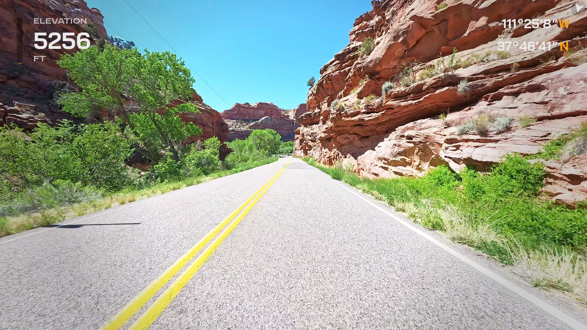
No, I’m not poking fun at Benedict Cumberbatch being terrified of the word “penguin.” I have no idea how to pronounce the name of the town I’m staying in tonight. And, I understand some of that fear as well. I was excited to ride Utah’s scenic byway 12, but after watching some of the videos and reading some of the commentary, I was more than a little apprehensive about a section described as the “vertiginous hogsback.”
Leaving from Torrey after a delicious breakfast at the Torrey Schoolhouse B&B with my fellow inn-mate couples from the Pacific northwest and England, I headed to my start of Route 12. Most descriptions of the road start west and go east. I was doing it “backwards,” I guess. Route 12 has the honor not only of being a Utah Scenic Byway, but also an “All-American Road,” because it takes you through several, dramatically different landscapes, and is a destination unto itself.
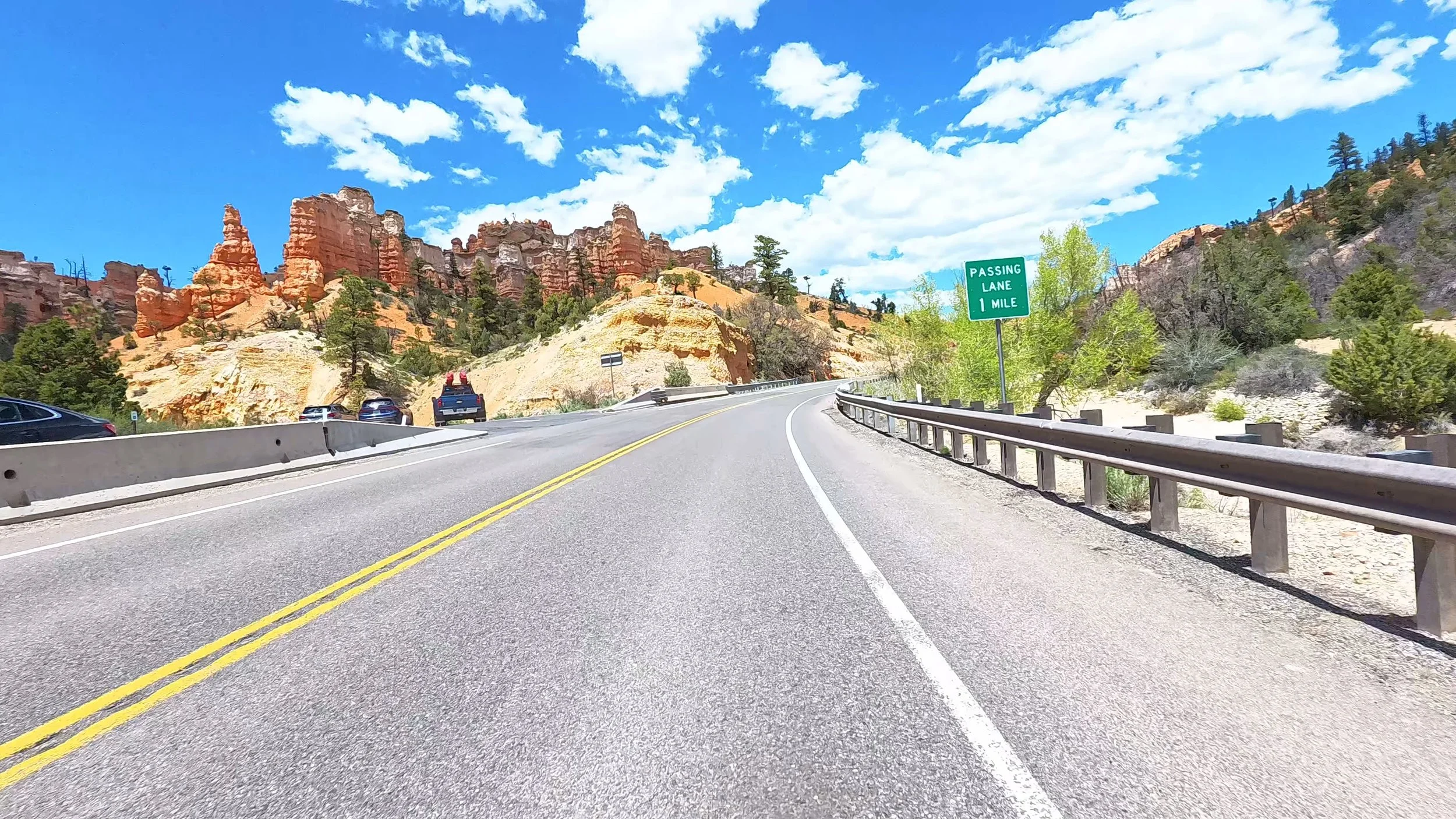
You can see from the elevation profile that the first part of the ride included a steep climb from 6,785 ft up to a little over 9,000 feet. There was still snow in places on the sides of the roads (on this part, the road actually had sides). Over the next couple miles, it went back down to 6,000 ft.
Now, it was time to climb up to the “hogsback” section. My anxiety was directly proportional to altitude, and when I got to the top and the first pull-out, I thought, “ok, this is fine.” Then, I passed that “Steep Grades, Sharp Curves, Next 4 Miles.” Basically, that section is 2 lanes wide, and well-maintained, but with 1,000 ft drop-offs on both sides. Notice my lane position stayed toward the center of the road, as long as there wasn’t someone coming the other way, and it was totally doable. After a bit of that, I started a 14% grade down with lots of turns, and that was just fun!
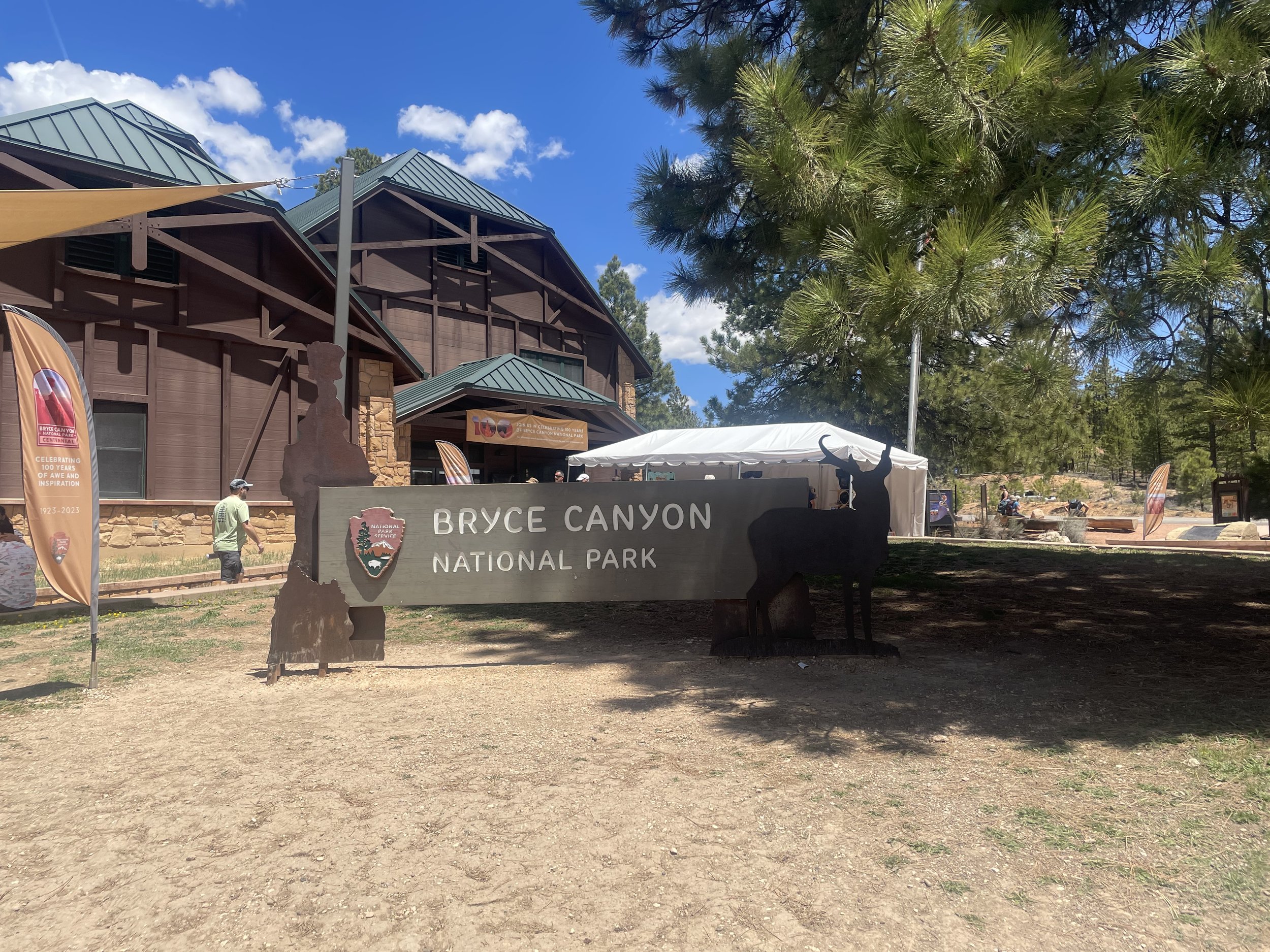
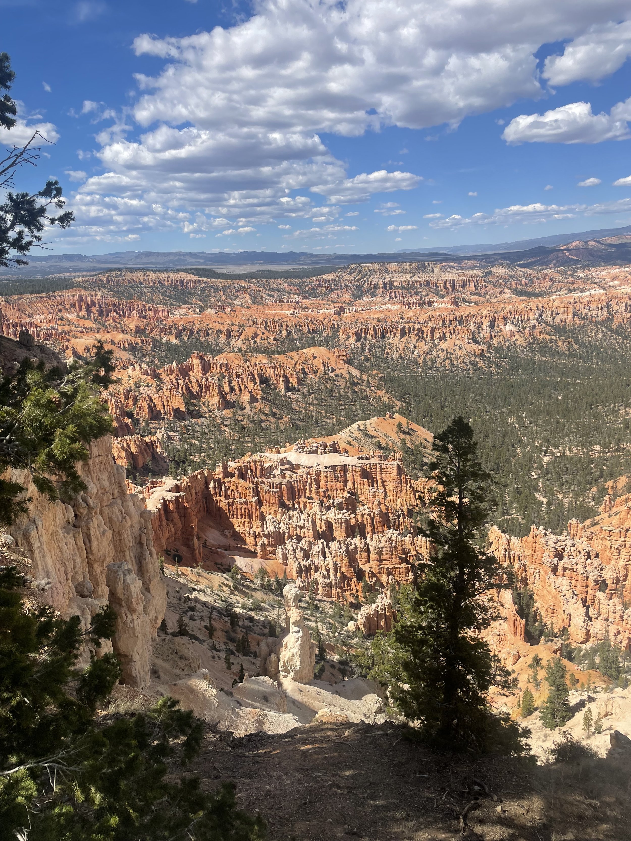
Through the Grand Staircase Escalante area, I eventually made it to Bryce Canyon National Park. Went to the visitors center. Got my stickers. And took off on the park road to Rainbow Point. There wasn’t a heck of a lot to see from the road itself, but there were lots of scenic turn-off points. And, those views of the canyon and the hoodoos were spectacular. I think it would have been even more amazin if I had the opportunity to do some hiking. But, it’s hard to do that in full riding gear, and it’s not like I can throw stuff in the trunk and head out for a couple hours. So, I see what I can from the road—and I know I missed so much that way. I’ll have to come back someday.
I headed out of the park, and over to my hotel. When I got there, they said that there were two choice for dinner. One was a half-mile east. The other was 8 miles back west. When I get to my hotel and stop riding for the day, I like to walk to dinner. A half-mile? No problem. Well, turns out it was a mile and a half. So, I had my dinner, and thought about the walk back. Fortunately, I saw a guy pulling in to the hotel where the restaurant was with his family, and asked him I he would drive me the mile and a half back to my hotel for $10. He said he’d be happy to. We chatted for a few minutes about my trip. He dropped me off, and wouldn’t take any money. Thank you very much for the ride Alejandro (I hope I spelled it correctly).
