Day 78: Going to the Sun…I mean Rain Road


Waterton Lakes National Park, AB Canada through Glacier National Park to Kalispell, MT
134.18 Miles | 8:17 Total Time
It’s Thursday, June 27, 2024, and it’s Day 78 of my cross country motorcycle trip.
Today was a big milestone on my trip. I’ve been looking forward to Glacier National Park and riding the Going to the Sun Road for several months. Today’s the day, and, of course:
My video camera is still broken, and there’s no place to buy a new one.
The forecast calls for rain.
There are no hotels available on the east side of the park, in the US for several days.
So…I’m going to give it a try and see how far I get. I can stop and take pictures with my phone, and I’ll get OK quality video. And, worst case, I turn around, cross back into Canada and stay in Waterton again—they have rooms.
First things first. Let’s cross the border back into the US. From the Waterton Lakes Park, it’s only 30 miles to the border. When I got to the border control, there was only one vehicle ahead of me, and they were pulling out. Border crossing…check.
Second, I had about another 30 miles to get to the park itself. The first 28 miles were great. No traffic and no rain. For the last 2 miles, there was still no traffic, but the rain started to come down. Right outside the park, I filled up with gas, had some coffee and waited a little for the rain to let up. Chatted with some folks. It went like this.
”Great day for a ride, huh?”
“Well, I’m going to get to the visitors center and see what the rangers have to say. Hoping it lets up.”
At the visitors center, the ranger’s advice was, “go. The weather changes so quickly on the pass that whatever data we have will be useless 10 minutes from now.” I met a guy in the visitors center who started in San Francisco and was bicycling home to Portsmouth, NH. He had just come down off the pass, had set up his campsite, and was drying out while using the wifi at the center. He thought I wouldn’t see anything and said wait for another day. At that point the skies opened up and it was raining so hard you couldn’t see out the center’s windows. Five minutes later, the rain stopped and took that as my cue to start my ride.
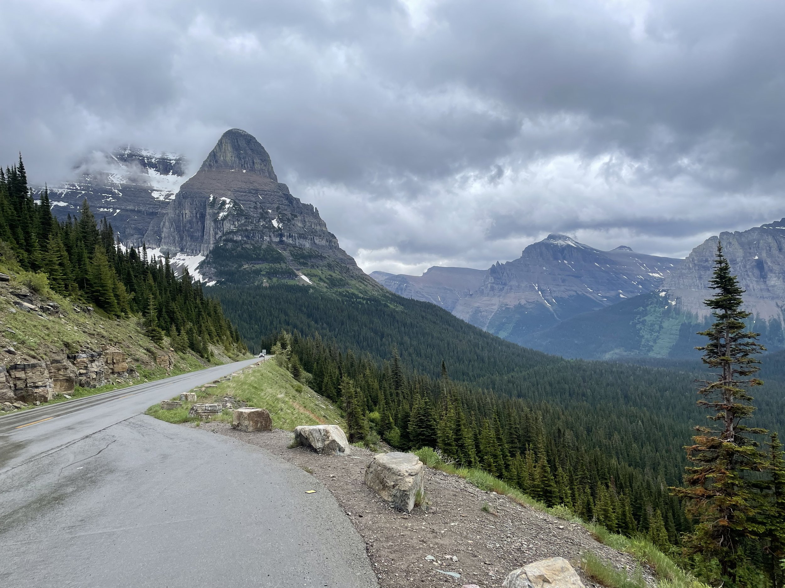
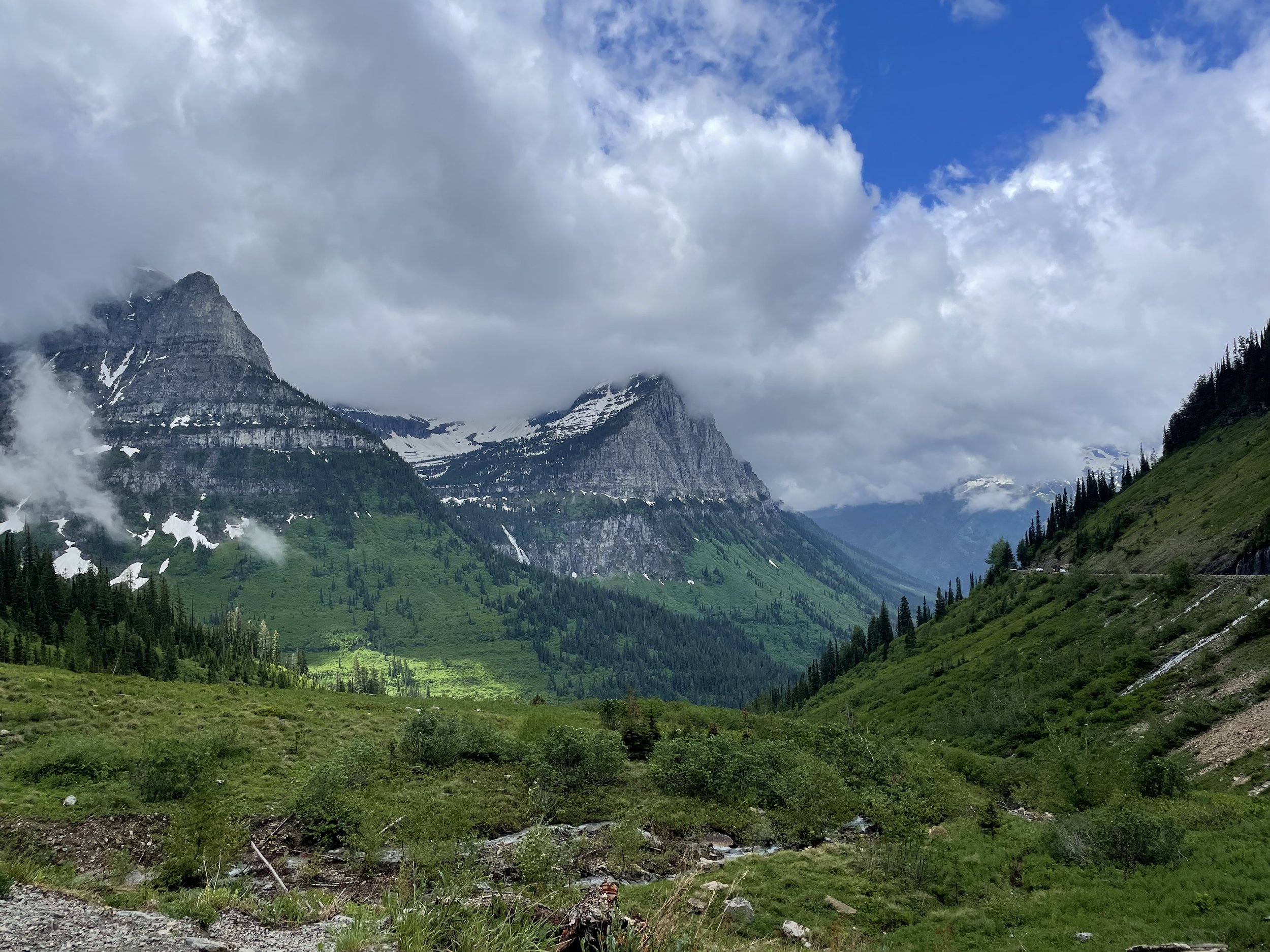
The full road is about 50 miles, and most people start at the west entrance and head east. The west entrance is where all the things to do and lodges are. It’s also where the closest big towns are and where the airport is. So, that’s usually quite busy, and they’ve started requiring timed reservations to enter from the west (before 6am or after 3pm you can enter without a reservation). I was going east to west for two reasons. First, they don’t require a reservation at all. Second, I’ll be riding on the mountain side of the road, as opposed to the cliff side of the road. Why will become obvious when you look at the some of the photos.
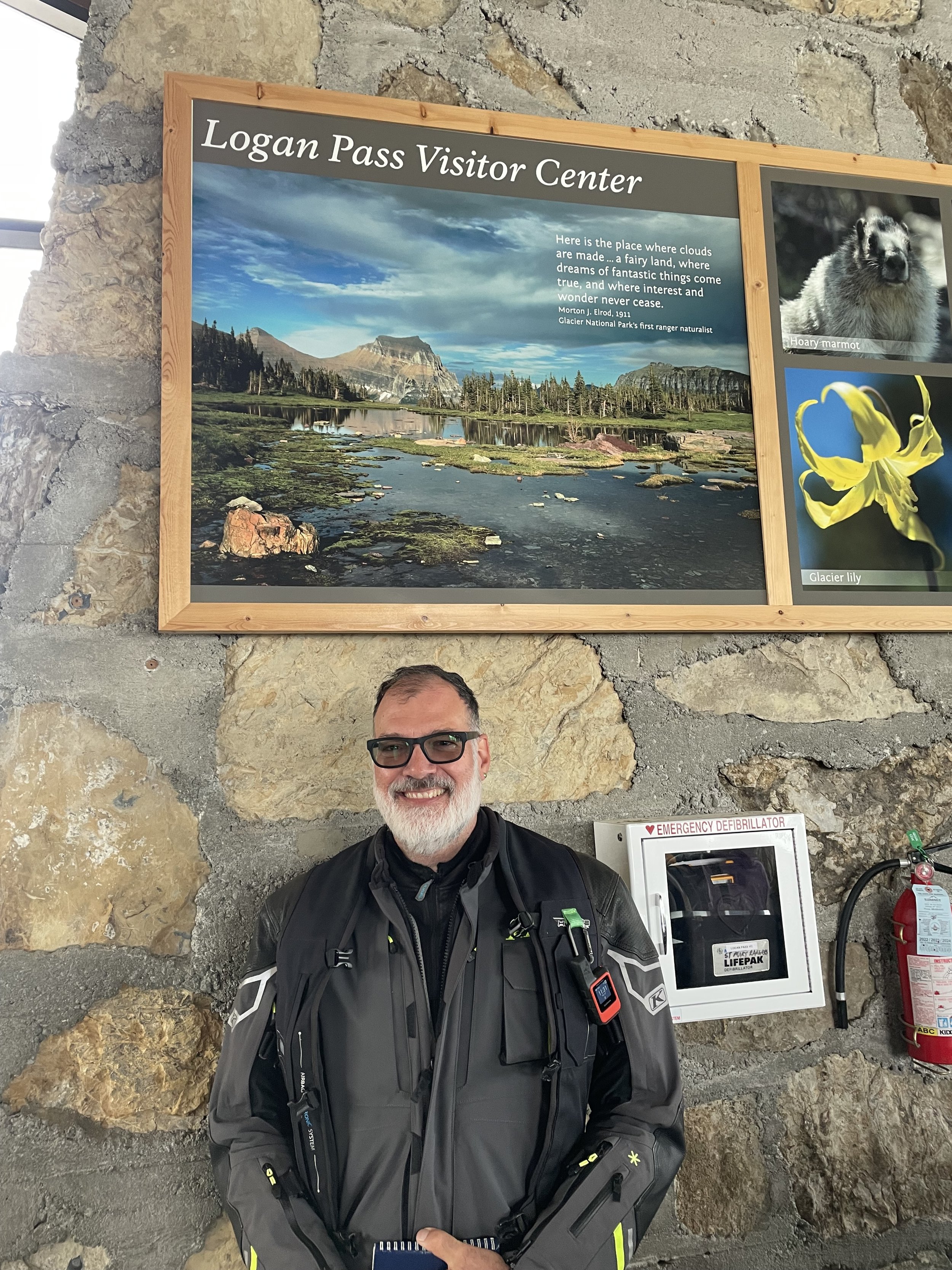
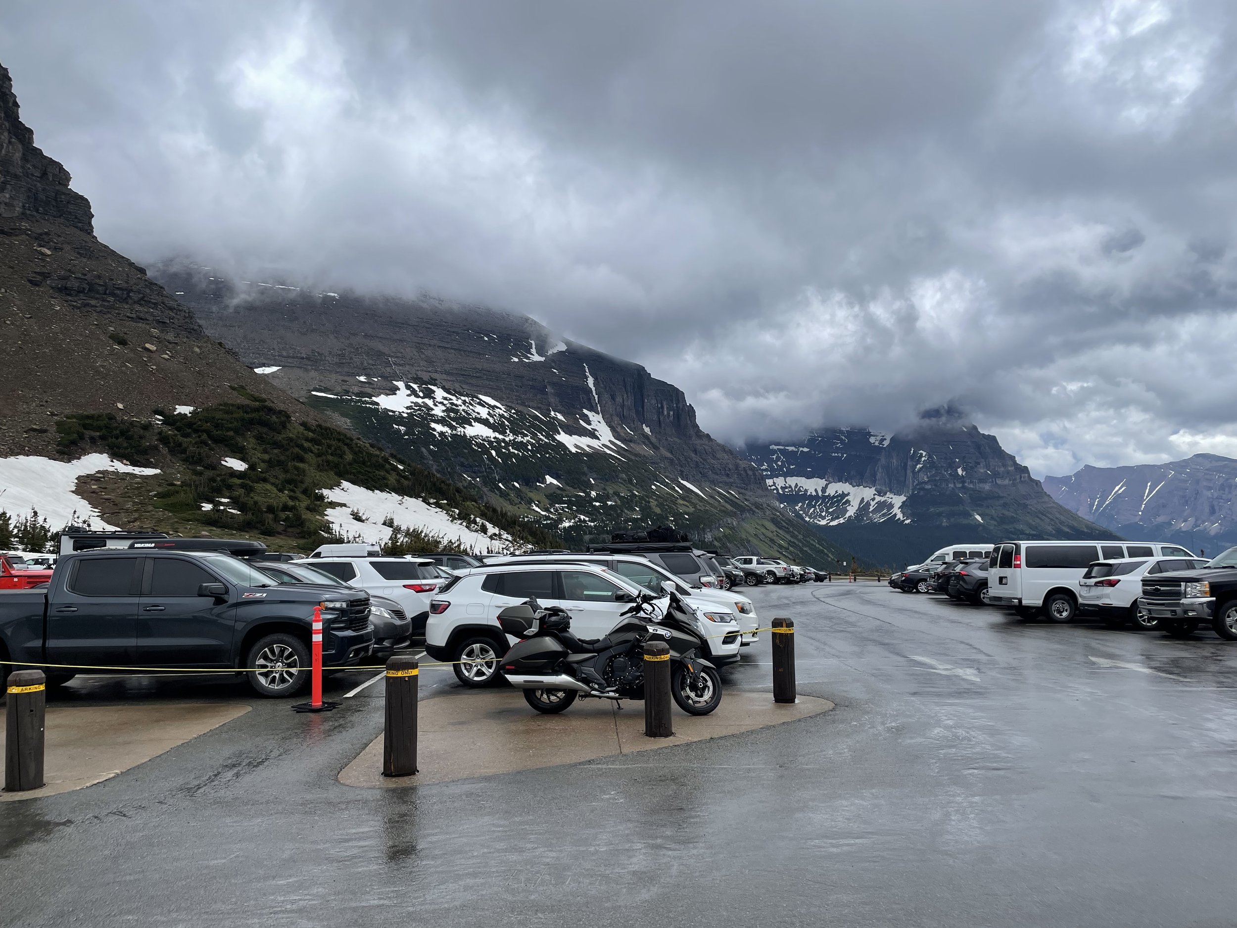
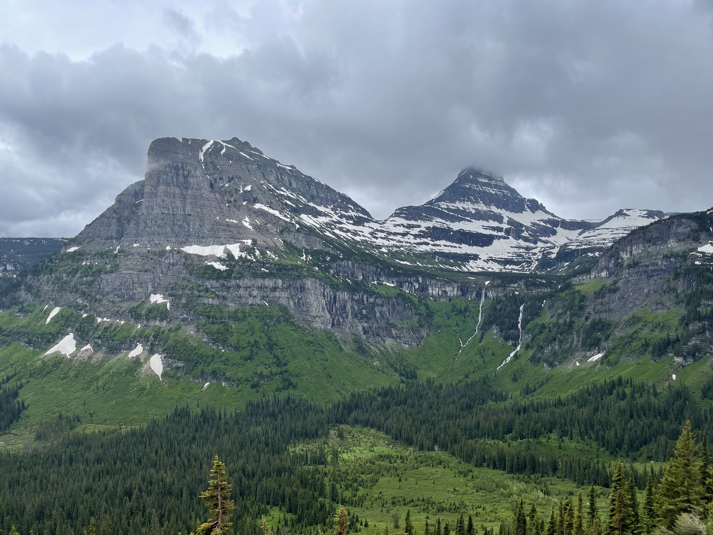
It was about 17 miles up to Logan Pass, which is the highest point on the road. They had motorcycle parking right up front, which was nice. I went inside, got some stickers, took some picutres, and my park passport stamped. As I was leaving, I noticed a “Continental Divide” sign that I didn’t know was there. It was too late (and too narrow) to turn around, so I missed that shot. If you go there, don’t forget to take your picture there.
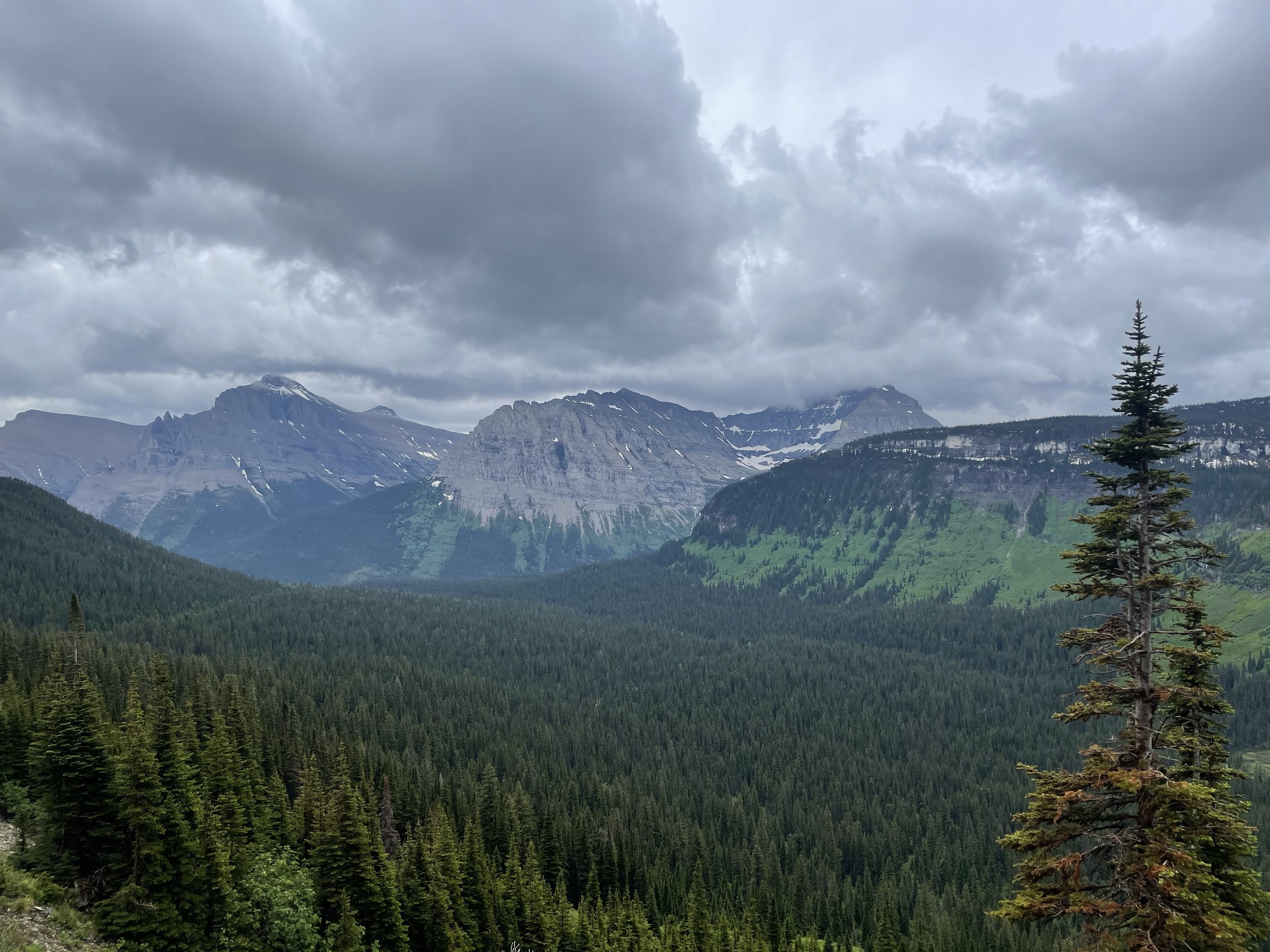
Then, I started the 33 miles west and downhill to Lake McDonald and West Glacier. About 10 minutes in to this part of the ride, the sun came out, and stayed out for a good, long time. When I got to Paradise Meadow, I stopped and took some more pictures, and was able to get the video camera going for the rest of the ride down.
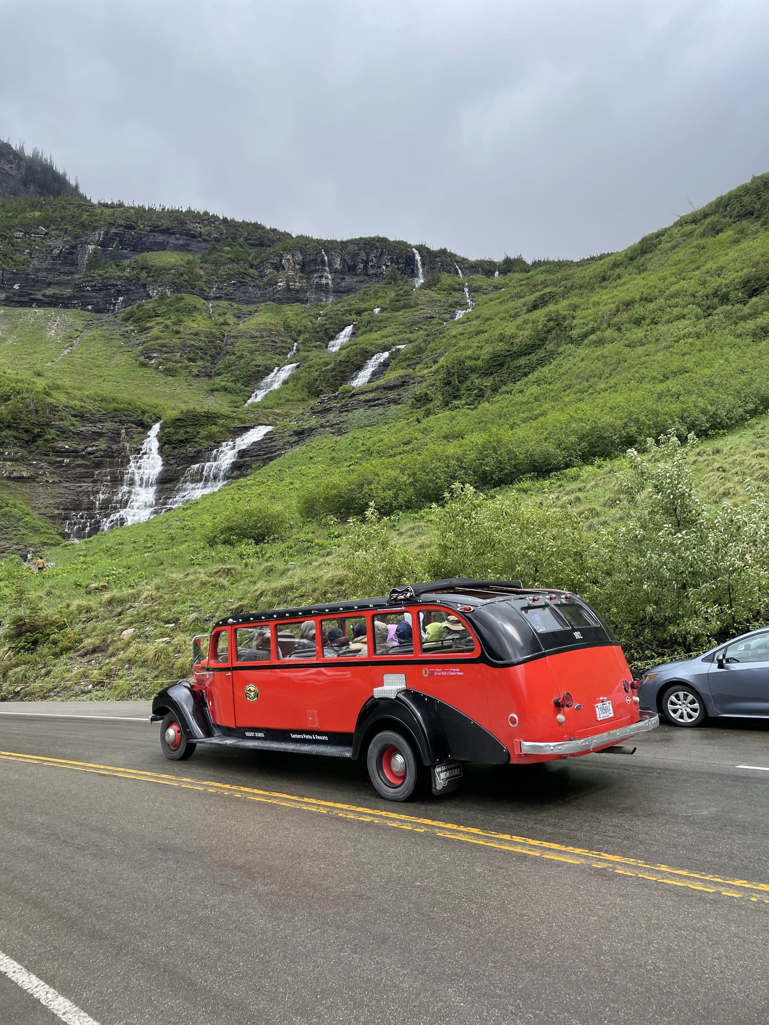
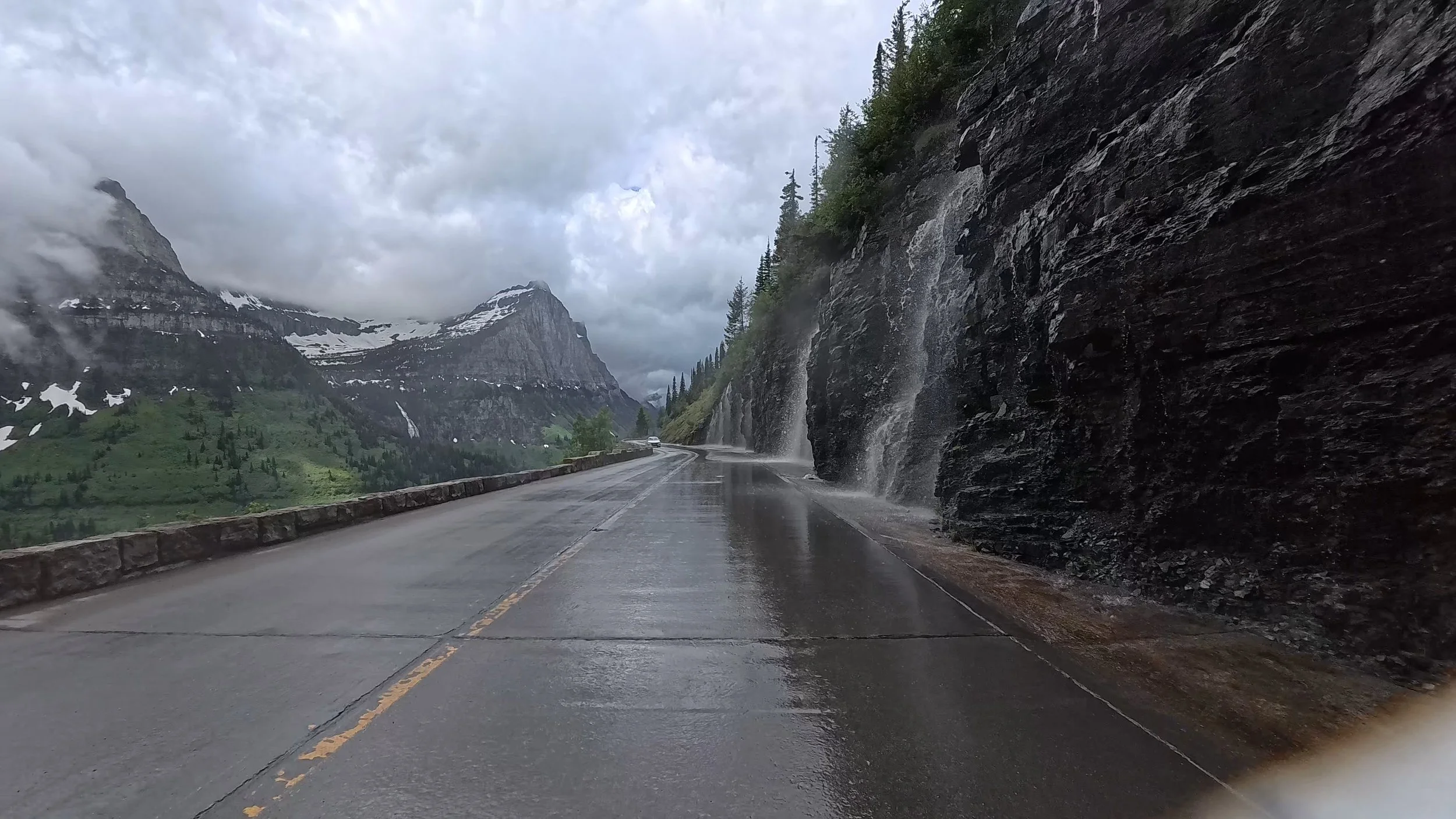
Just after Paradise Meadow is the Weeping Wall. This was one of the most amazing parts of the ride. Some of the waterfalls just flow down, across the road, and over the cliff—it’s wild.
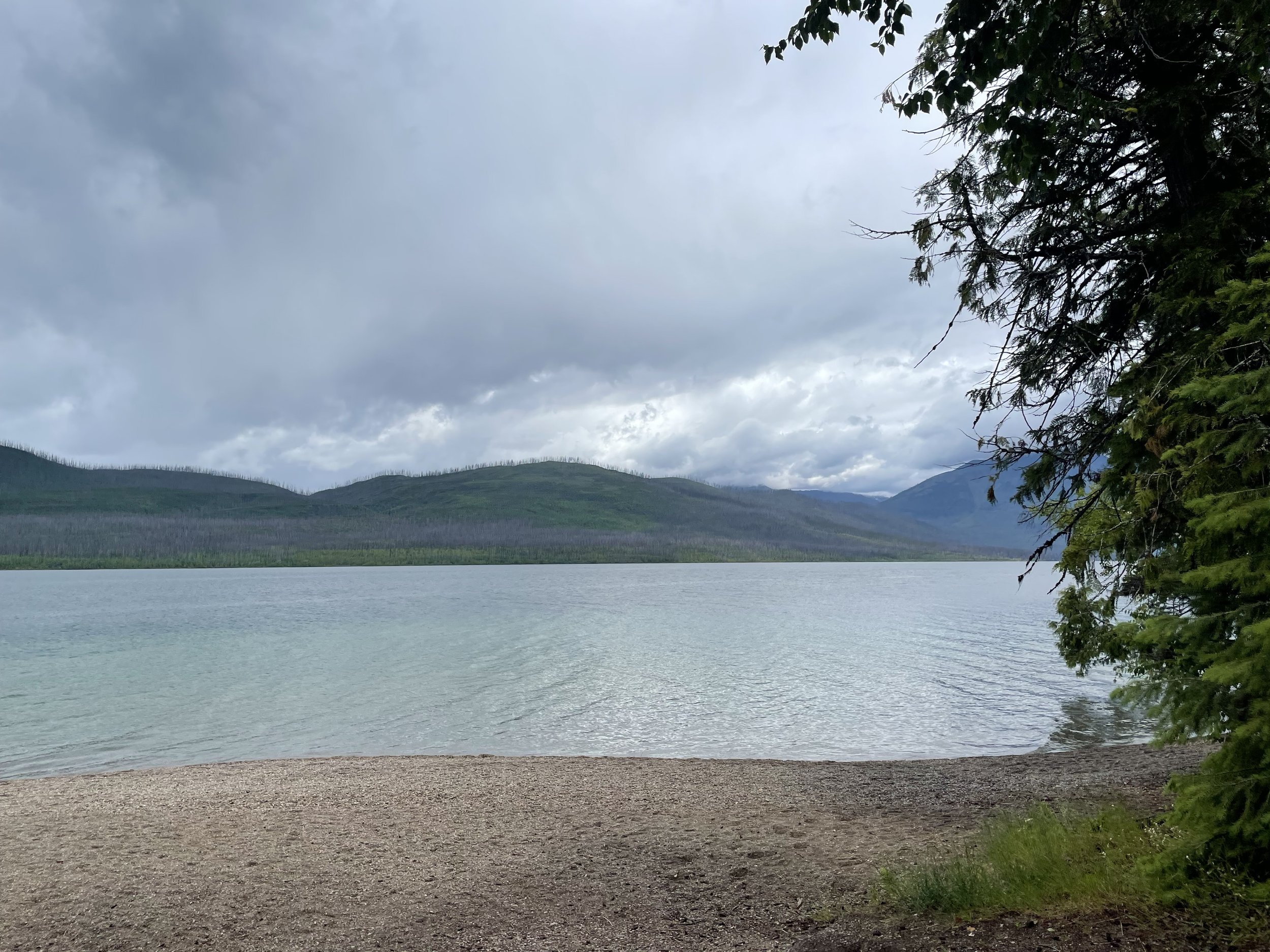
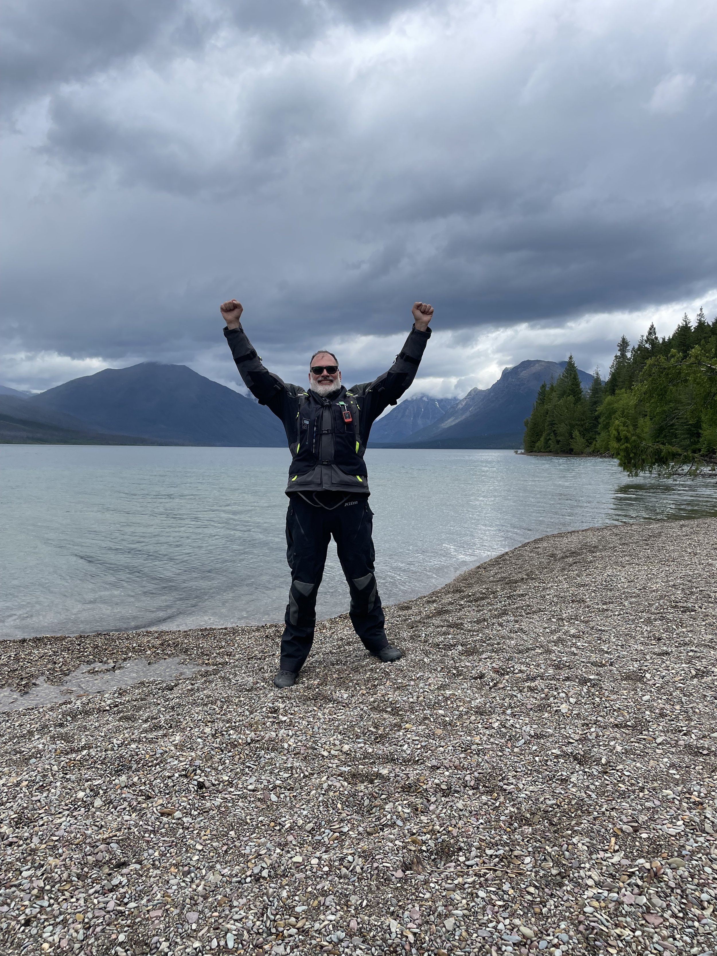
Down in the valley, the road follows the river into LakeMcDonald, where I celebrated my victory and crossed Going to the Sun Road off my bucket list.
At the Apgar visitors center, I got my 3rd park passport stamp of the day (each visitors center has a unique stamp), and relaxed for a bit. I talked to Donette for a bit, and shared that the rain wasn’t bad today.
I had about 45 more minutes to get to my hotel, and 40 of those were spend in a downpour. Fortunately, my gear kept me warm and dry, but it’s always unpleasant dealing with the rain from above, the spray from the cars, and the impatient drivers who don’t realize how much less traction a motorcycle has in the rain vs a car.
As I was getting in to Kalispell, I saw that there was a Best Buy store right across the street from my hotel. I stopped in and bought a new camera! I bought the service plan on my original camera, so when I get that replaced, I’ll just sell it. After that, I got to my hotel, dried off, and got some dinner. What a great day!
