Day 69: Can’t Get Anymore Northwest


Port Angeles, WA to Cape Flattery, Olympic National Park, and back to Port Angeles
194.54 Miles | 5:11 Riding Time
It’s Tuesday, June 18, 2024, and it’s Day 69 of my cross country motorcycle trip. And…Happy Birthday Edward. I miss you.
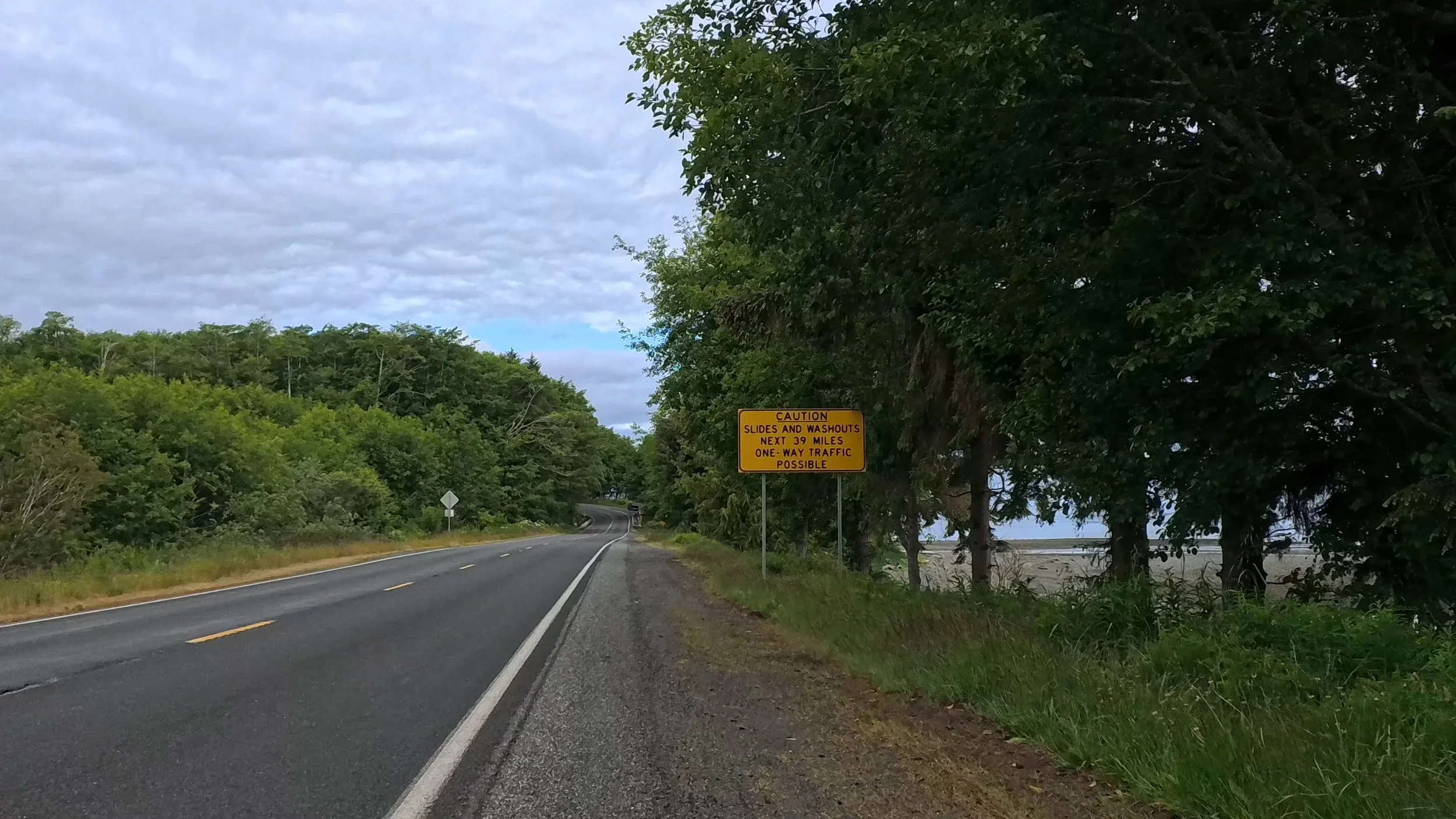
One of my goals for this trip was to see Cape Flattery. It’s the most northwest point in the contiguous United States, and sits inside the Makah Reservation, near Neah Bay, Washington. It’s about as far from New York City as one can get without crossing an international border or body of water. It’s not that it’s particularly hard to get to, but it is a place you have to set as a destination—you’re not likely to ever just be passing through.
It was breathtaking. The ride there was only 78 miles, but it took about 2 hours. The roads were both rough and twisty. And the views along the way of the Straight of Juan de Fuca. At Neah Bay, you purchase your Makah Reservation Recreation pass for $20, which lets you visit all the scenic sights within the reservation—good for the calendar year.
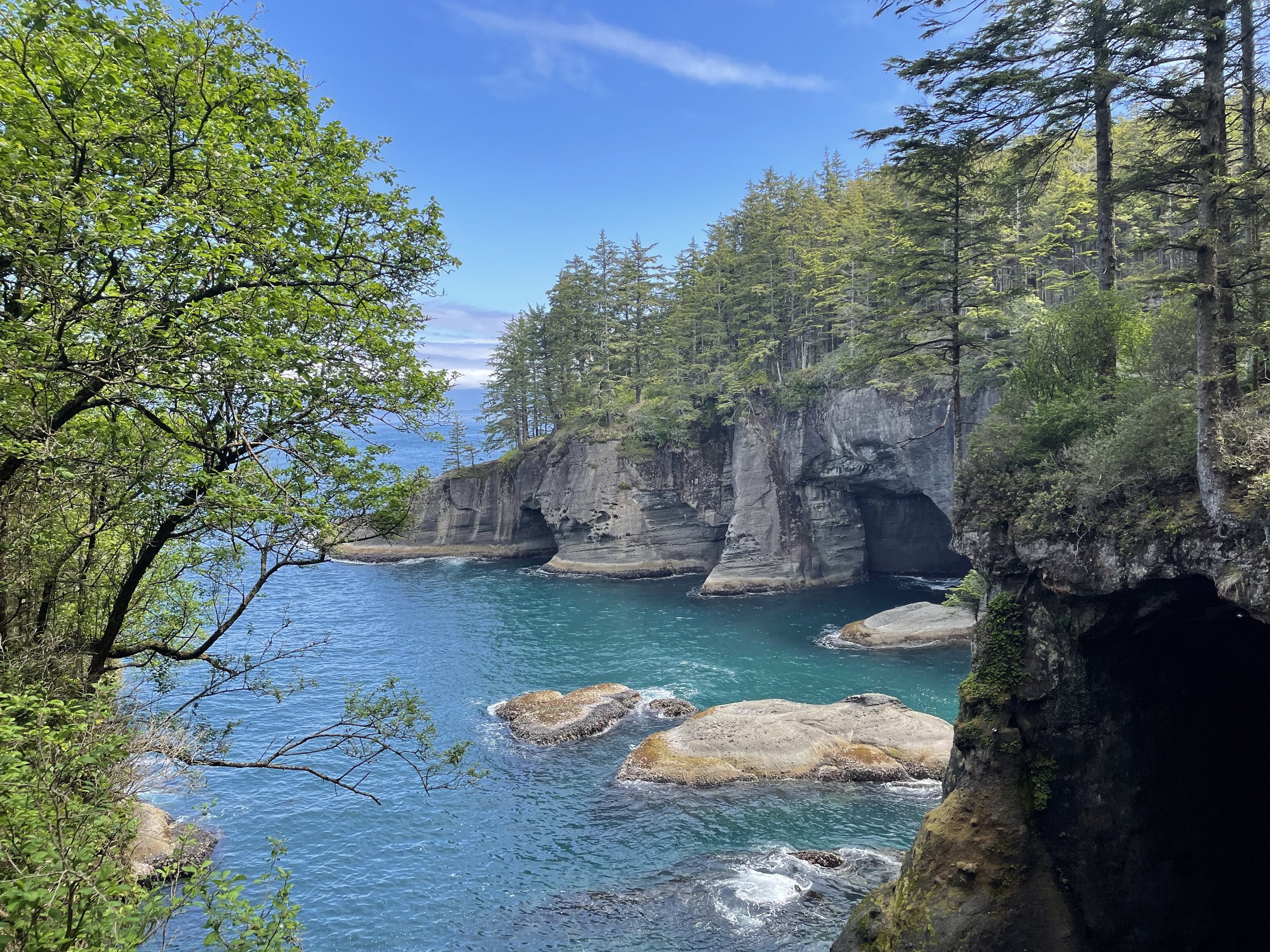
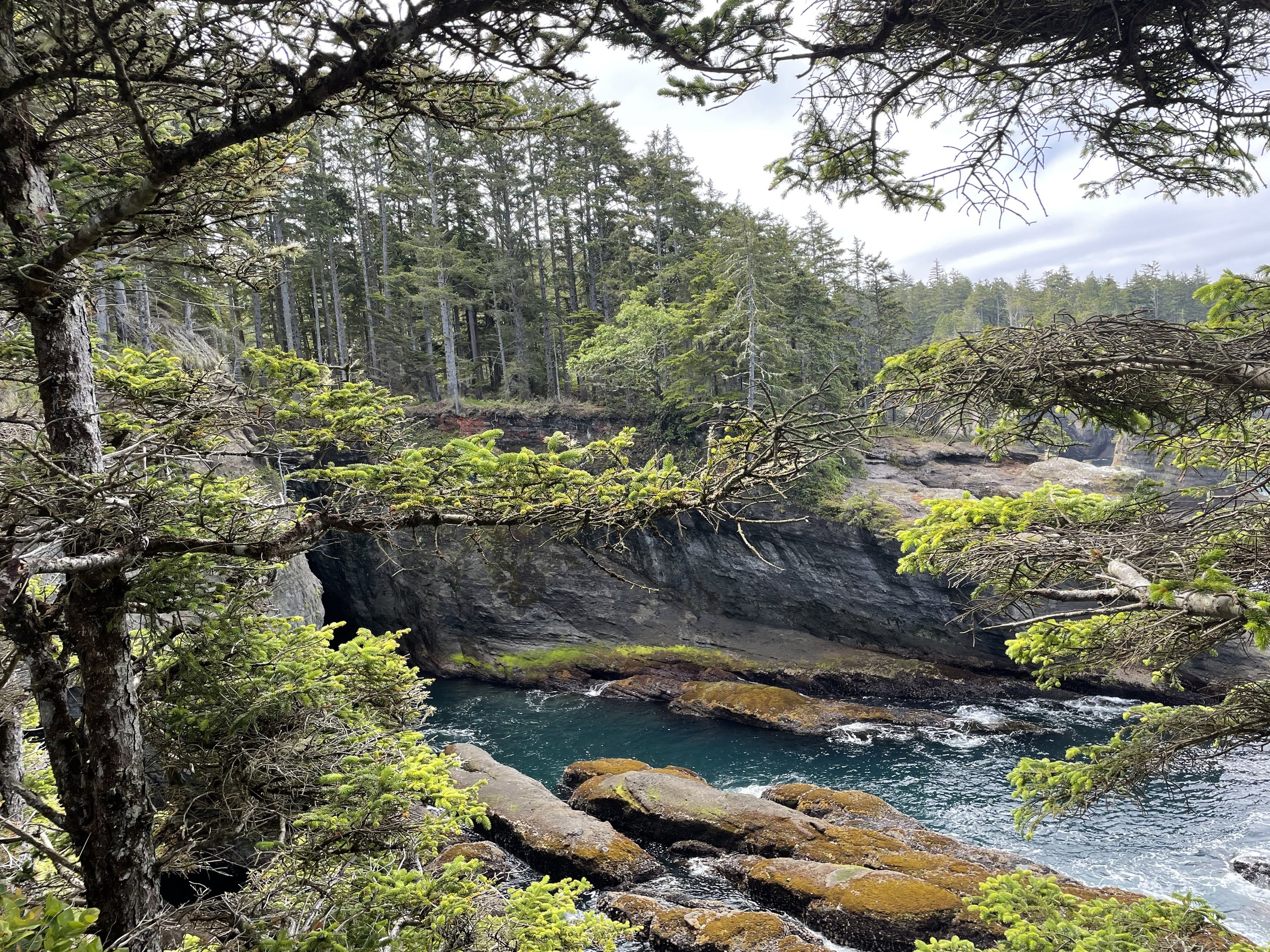
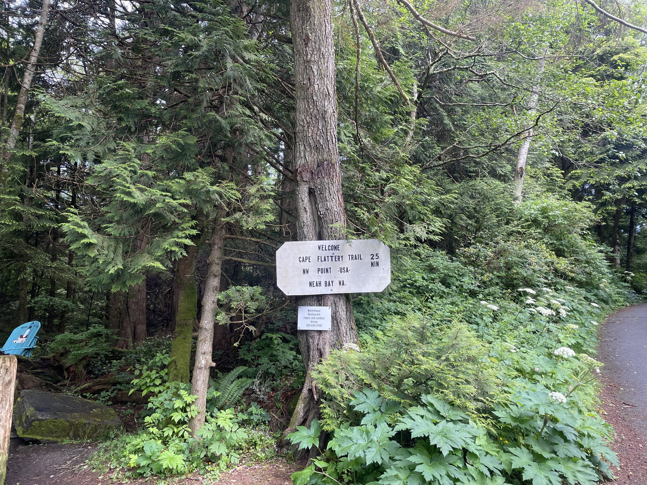
At the end of Cape Flattery Road is Cape Flattery Trail. It’s about 25 minutes, and a relatively easy hike down through the forest, and along some boardwalks. It’s about 200 ft elevation loss from the parking lot to the observation deck. There were about a dozen other folks there. Everyone was taking pictures (and helping to take group photos for each other) and commenting about how amazing the views were. The cliffs, caves and waves were all coming together, and the weather was absolutely gorgeous. I spend about an hour there before hiking back up to the parking lot.
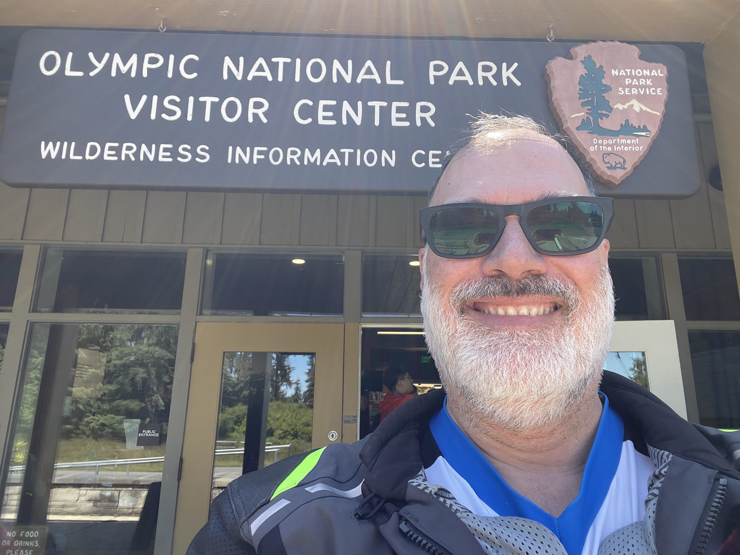
On the way back to Port Angeles, I went over to check out the Olympic National Park Visitors Center, and get my stickers and national park passport stamp. It was then I learned that the road up to Hurricane Ridge was only 17 miles and took about 45 minutes each way. After my ≈150 miles so far, I still had another 34 miles in me. So, I headed up to Hurricane Ridge, and was in awe of the scenery yet again today.
The ride up is nicely paved, well marked and generally traffic free. It winds through some beautiful foothills as it climbs from sea level to the temporary visitors center at 5,242 feet (the visitors center and lodge burned down last year). The peaks were well fogged in when I was there, but glimpses of the snow-covered Olympics were available for brief moments.
Back in Port Angeles, I had a nice dinner at Moby Duck Chowder and Seafood, and some ice cream at Welly’s before turning in for the night.
